| vf_node_pictures_all | title (item) | field_cer_web | field_cer_navbox | g_geofield | g_geofield | |
|---|---|---|---|---|---|---|
|
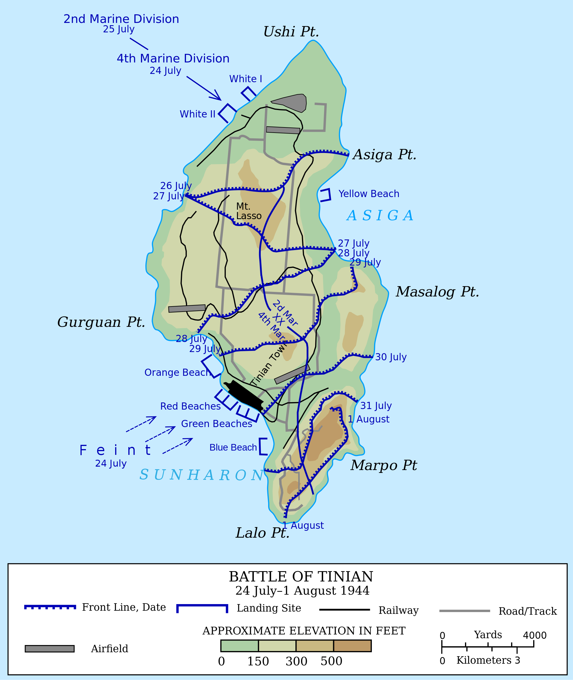
Battle of Tinian |
Description
English: Map of the US-led invasion of the island of Tinian in the Northern Mariana Islands, constituting the en:Battle of Tinian (Battle of Tinian) in 1944.
Most of the map taken from File:Battle_of_Tinian_map.jpg, a work of the US Department of Defense. Additional details from:
Richard Harwood. Jig Day: Feint and Landing. A Close Encounter: The Marine Landing on Tinian. National Park Service. Retrieved on 17 June 2012.
Richard Harwood. The Landing. A Close Encounter: The Marine Landing on Tinian. National Park Service. Retrieved on 17 June 2012.
Rottman, (Gordon L. (2004) Saipan & Tinian 1944 - Piercing the Japanese Empire, Osprey Publishing, p. 86
D. Holmes, Jnr. publisher=Hyperwar. Capture of Tinian. Retrieved on 18 July 2012.
File:Maps_template-fr.svg
Date 17 June 2012
Source Own work
Author Grandiose