field_i_picture
vf_node_items

field_in_sequence
25
field_t_remark
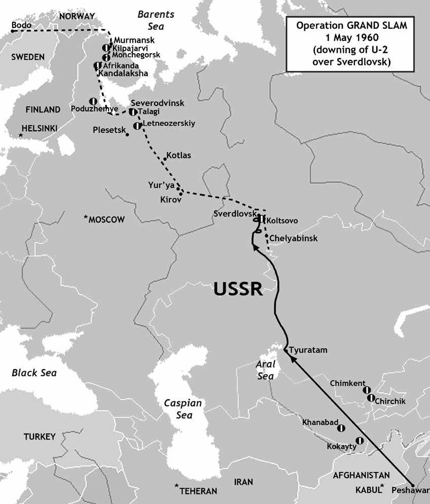
A map showing the route taken by Powers during Operation Grand Slam, based on Soviet radar tracks. Notably, after losing his autopilot, the CIA flier experienced significant problems with keeping a steady course. Also notable is that, according to Soviet data, Powers did two full 360-degree turns – one south and one west of Sverdlovsk. The dotted line indicates the course Powers was supposed to fly after passing Sverdlovsk – part of which was to bring him directly over an entire chain of major Soviet air bases on the Kola Peninsula. (Map by Tom Cooper)
field_t_subtype
map
fr_quality